The third day of the Salkantay Trek to Machu Picchu is by far the most challenging day of the entire hike, taking you up a series of switchbacks to reach the Salkantay Pass, the highest point of the trek at 15.213 feet/4636m. This is the biggest test for hikers to see how well they have acclimatized to the high altitude. Yet in my opinion, it is one of the most rewarding days of the journey for its awe-inspiring views and feeling of accomplishment.
We rose early after a fabulous dinner at the Salkantay Lodge, Mountain Lodges of Peru’s hallmark lodge in Soraypampa. Since we were traveling with Mountain Lodges of Peru (MLP), we would be the only hikers ascending to the pass on foot, since MLP is the only outfitter that has accommodations in Wayraccmachay, a plateau located three hours after reaching the pass. There are no campgrounds there so everyone else hiking normally ascends the pass on horseback and then continues past Wayraccmachay to the next village, where we would hike the following day.
For us, it was magnificent because it meant we would have the entire trail to ourselves for two days. As an avid hiker, this is a very special treat!
We started our hike at 7 am and were blessed with an absolutely stunning day. Had it been cloudy, we would have seen nothing.
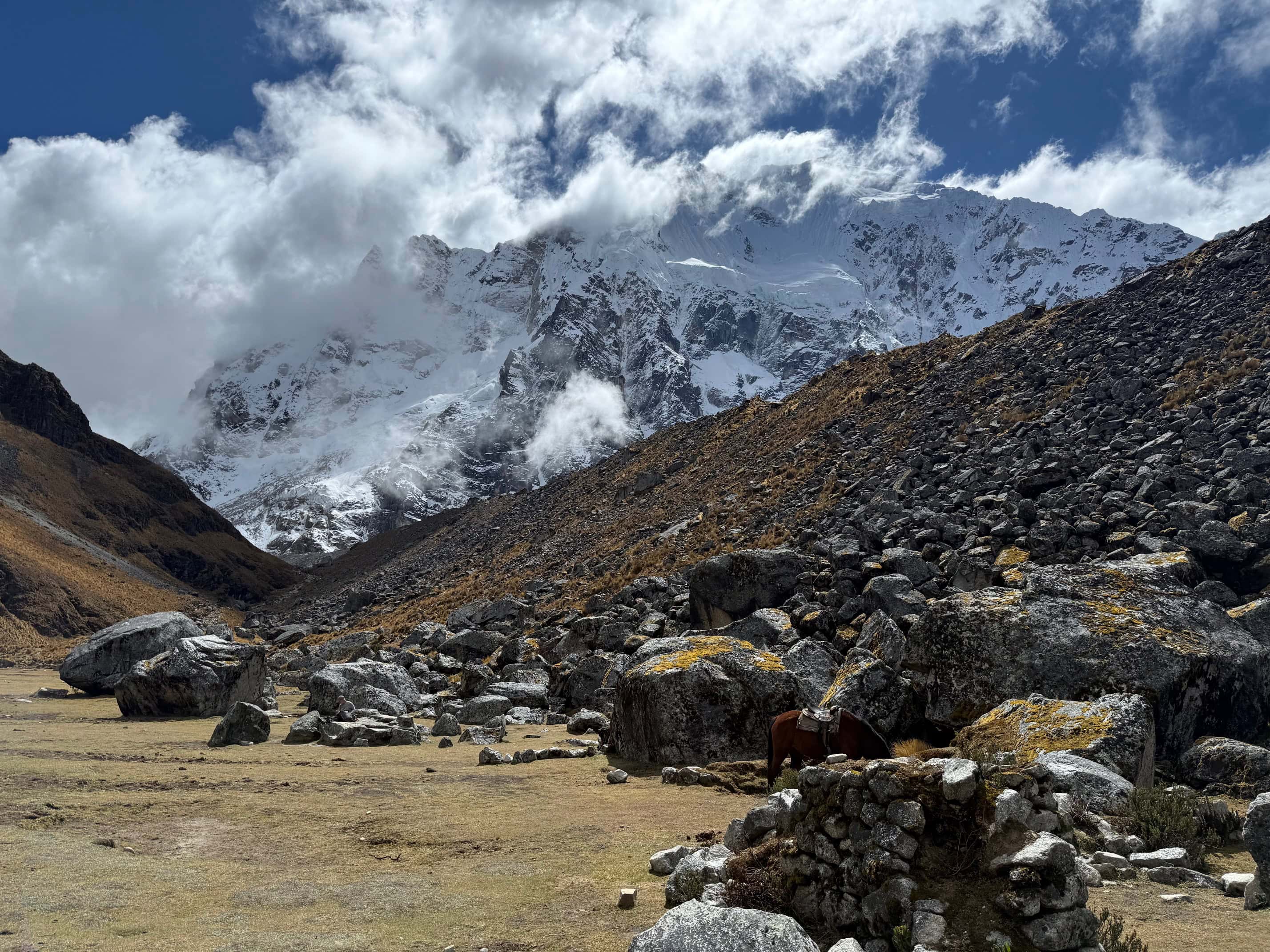
We were incredibly lucky to have surreal views of the snow-capped Humantay Peak.
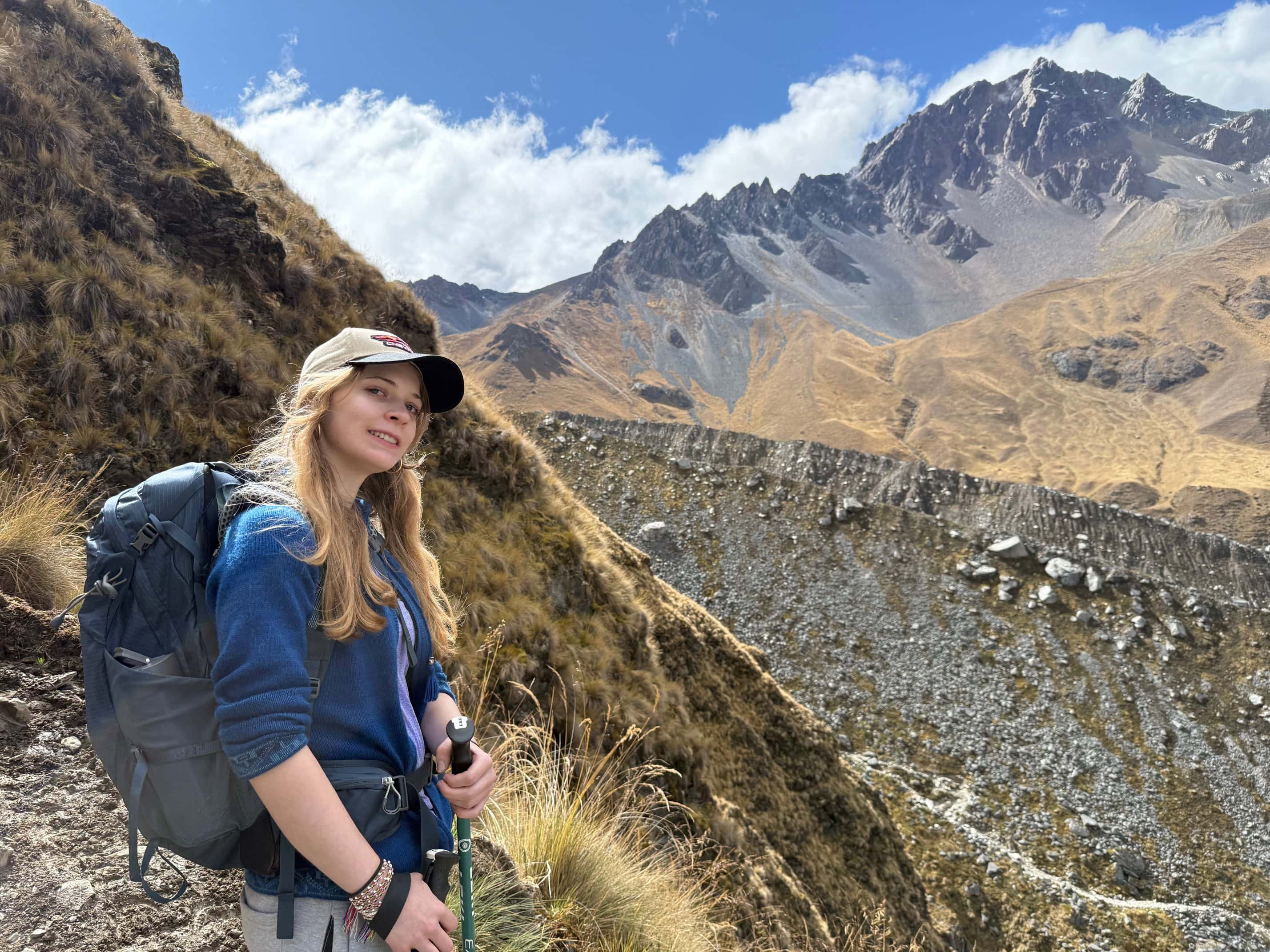
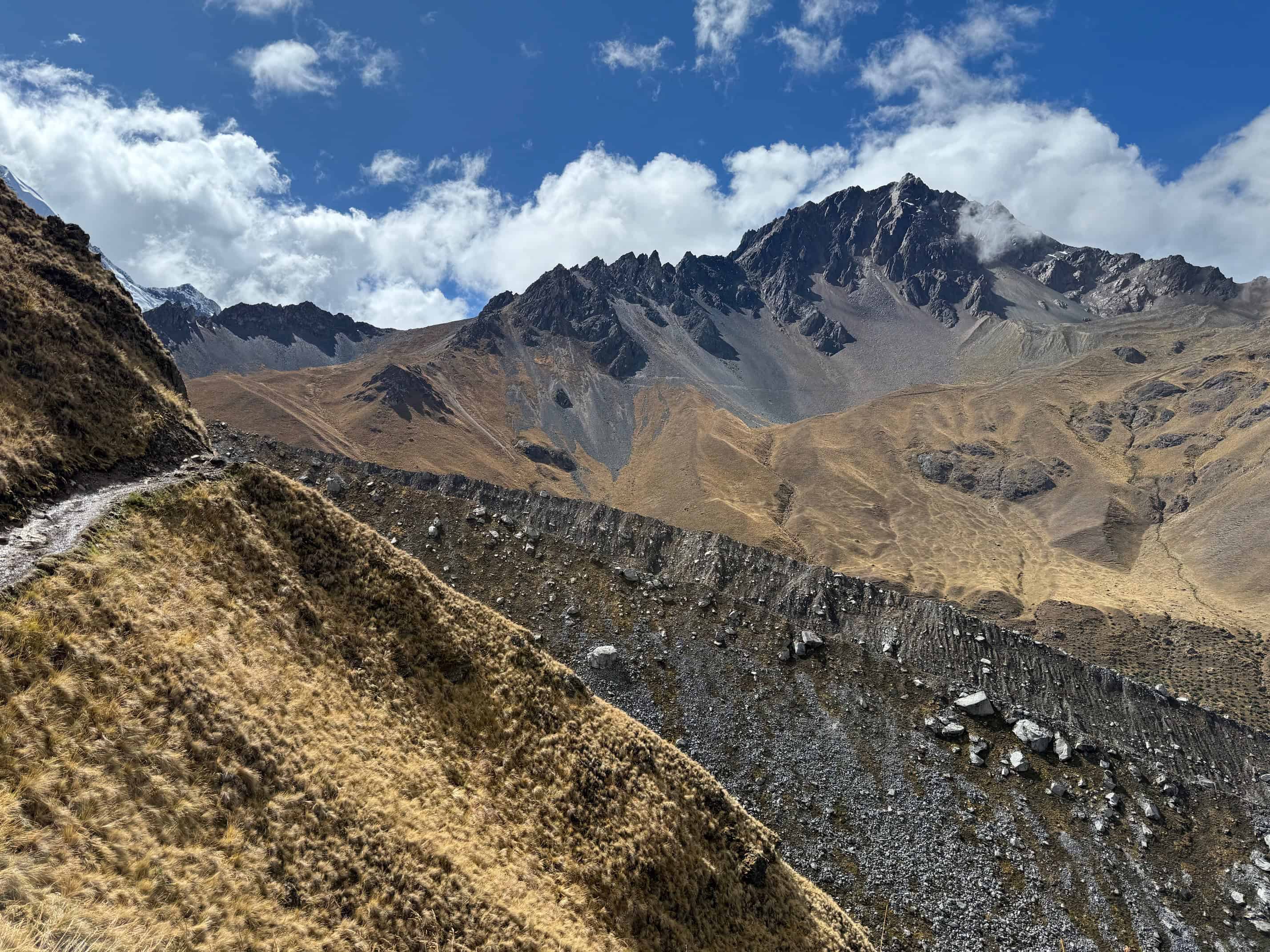
As we climbed up, our lungs pounded as we acclimatized to the higher altitude. We circled Humantay Peak, with stunning views of expansive plateaus connected by enormous boulders, and remnants of the Rio Blanco Valley.

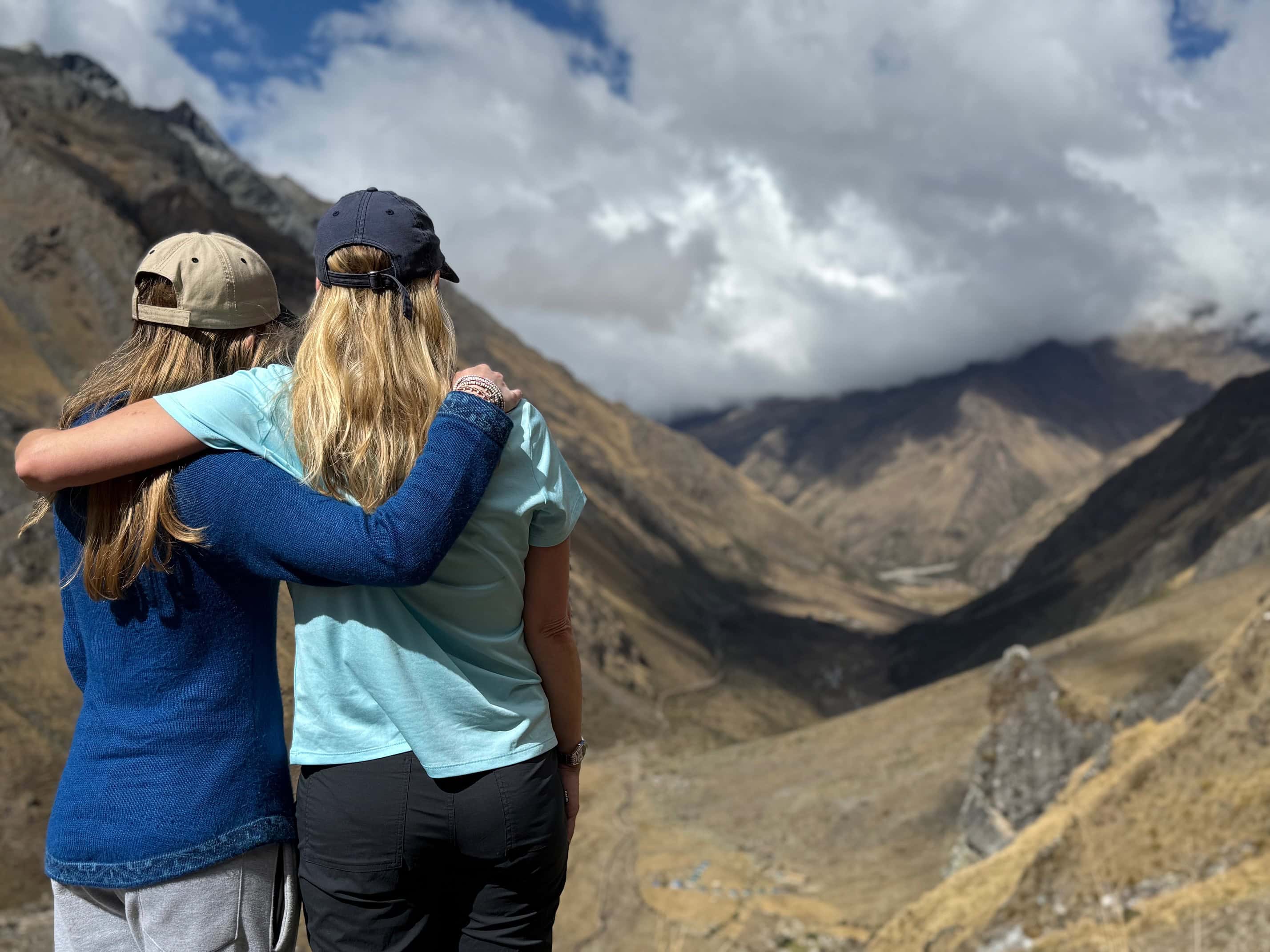
I felt really good and did not take altitude pills since I have not had any issues before with altitude. However, it was a challenge for my daughter as she had never been this high before and was struggling with her breathing. We took it slow, stopping frequently to catch our breath and take photos. The views were so spectacular that it helped.


We reached the pass around 11:30 am, taking 4.5 hours (with a half-hour stop for a snack before the final push). It was an exhilarating feeling to stand at the top of the highest point of the hike with my daughter. I was so proud of her! Especially since she has been suffering from unexplained migraines and lightheadedness for several months. Even her doctor, treating her for this condition, was amazed.


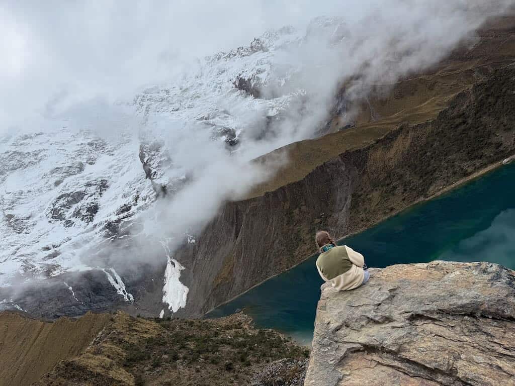
Clouds coming over the mountains at the pass. We timed it right as it would cloud up soon taking away the stunning views of the mountains
After the pass, we continued for another three hours hiking through rolling hills and boulders to reach the Wayra Lodge at Wayraccmachay. This is the only place to stay here – there are no campsites. If you are not hiking with Mountain Lodges of Peru, you have to continue to the next village. This is why we saw the other groups on horseback going up the switchbacks to reach the pass earlier. If they hiked it all in one day, it would be extremely difficult and almost impossible to make it before sunset.
It had clouded up, so I didn’t take many pictures after the pass. We were tired as well and ready to finish the hike.
Around 2:30 pm, we saw the lodge off in the distance. I could hardly wait!


This would be one of my favorite places we stayed during the hike. It was so isolated. I tried to imagine how hard it must have been to build this place, as there are no roads and it can only be reached on foot and with the help of mules.
If you go: We booked our trip through Mountain Lodges of Peru, the only outfitter who has lodges along the trail. From start to finish, they were absolutely incredible. I highly recommend them.